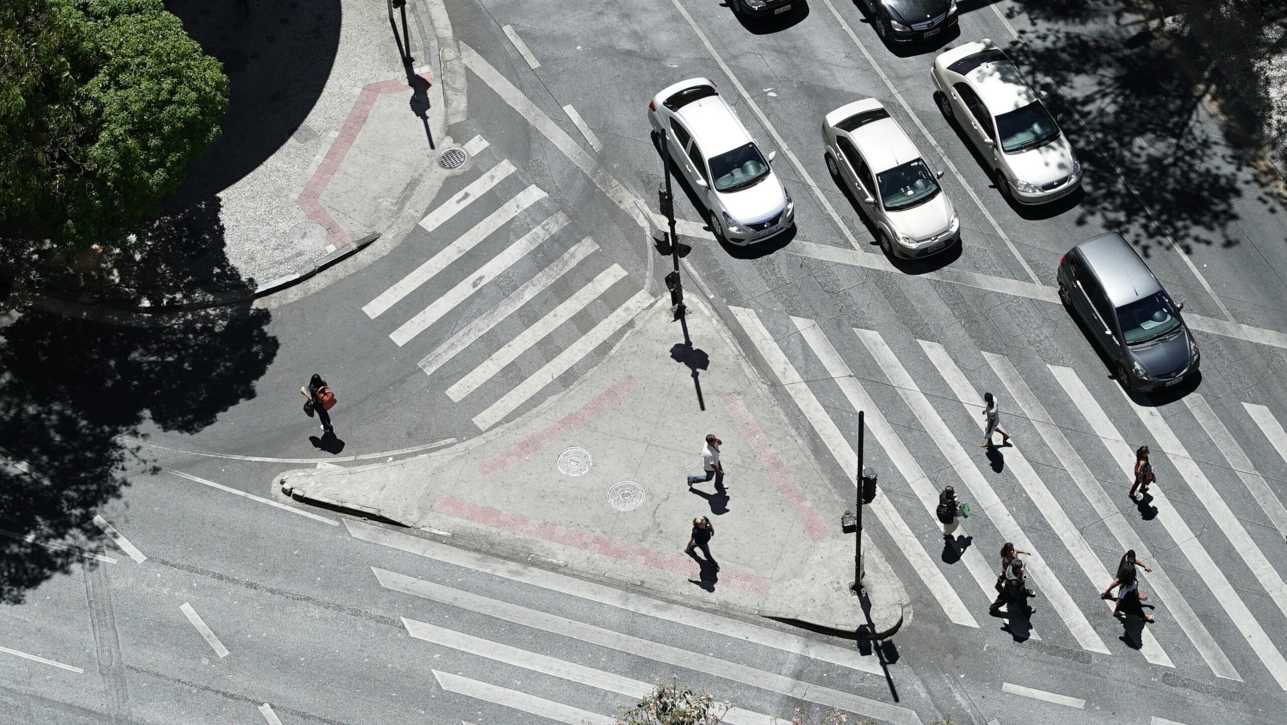
Urban streets are becoming increasingly complex and are having significant impacts on road safety. Growing population density, a rise in cycling and micromobility, and continued reliance on private vehicles are intensifying competition for limited road space. This complexity has disproportionately affected vulnerable road users (VRUs). VRUs, including pedestrians, cyclists and micromobility users, represent 70% of all road fatalities in cities. This underscores a persistent mismatch between how streets are used and how they are designed and managed.
Road safety continues to be a priority for the EU with its Vision Zero goals. The vision sets out a 50% reduction in fatalities by 2030 and 100% reduction by 2050. Whilst the number of fatalities in 2024 fell on average across the EU by 2% compared to 2023, progress is slow and remains a challenge for all cities.
Improving road safety in cities requires a holistic approach. Such an approach needs to integrate smart street design, data-driven and predictive technologies, and behavioural insights. In 2025 EIT Urban Mobility supported three projects, ROADSCOR, SAFELIGHT and SAFELY. These projects are helping the shift from reactive to data-driven preventative road safety. Using advances in AI, computer vision, digital twins and geospatial analysis, they are helping cities to identify risks before accidents happen, and redesign streets accordingly.
ROADSCOR
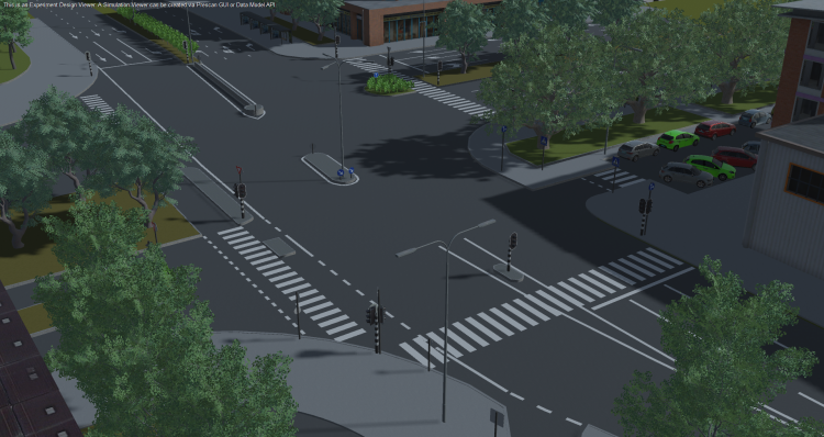
Led by Roadscor, the piloted a predictive safety solution to proactively assess risk at intersections in Hasselt, Belgium; and Verona and Rome, Italy. The projeced used a digital model of intersections to simulate thousands of interactions between road users. The Roadscor platform identified potential conflict situations including minor and near-misses. For each intersection between 4,000 to 40,000 simulations were conducted, typically resulting in 100+ conflicts. These insights are critical for cities to prioritise locations and allow for the evaluation of interventions before implementation.
Using Roadscor’s conflict-based analysis, Rome tested both existing and proposed layouts through a digital twin. The digital twin was built from traffic counts, floating car data and estimated pedestrian volumes at one of the city’s most dangerous intersections. Thousands of interactions were simulated to assess the likelihood, severity and preventability of conflicts. The results confirmed the urgency of intervention. The existing layout showed over 370 potential collisions and more than 430 near-misses, with motorcycles and pedestrians particularly exposed. When the redesigned layout was tested, conflicts dropped by around 67%. The overall risk score was reduced by nearly 50%. Based on the findings from the project pilots, the solution’s algorithms have been further refined. Additional functionality has also been added for determining the severity and costs of conflicts.
The ROADSCOR project was a collaboration between Roadscor, Siemens, Aimsun, HaskoningDHV and FIA.
SAFELIGHT
The issue of poor illumination of roads and pedestrian crossings is a critical issue impacting road safety. Typically, the evaluation of illumination conditions in cities at night has been performed both visually and using manual luxmeters. However, these are largely resource intensive and inefficient methods that can fail to analyse visibility in all types of conditions and across the entirety of cities.
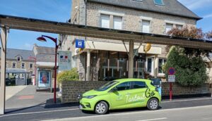
The SAFELIGHT project consisted of the development and validation of ASIMOB’s ‘Autonomous Inspector for Lighting’. A computer vision-based AI solution, it allows for the evaluation of the lighting in cities automatically. The solution was piloted in Las Rozas and Vitoria-Gasteiz, Spain and Brasov, Romania. The solution was used to detect areas of low visibility frequented by vulnerable road users (VRUs). Based on the results, Flash Lighting Services recommend changes and additions to lighting solutions specific to each location. Additionally other recommendations were made relating to surrounding vegetation reducing visibility. Based on the analysis, Las Rozas and Brasov made modifications, with the aim of improving road safety and preventing accidents. Following the implementation of these changes, a second automated inspection was performed to validate the improvement for VRU visibility.
The SAFELIGHT project was a collaboration between ASIMOB, Flash Lighting Services and Las Rozas Innova.
SAFELY
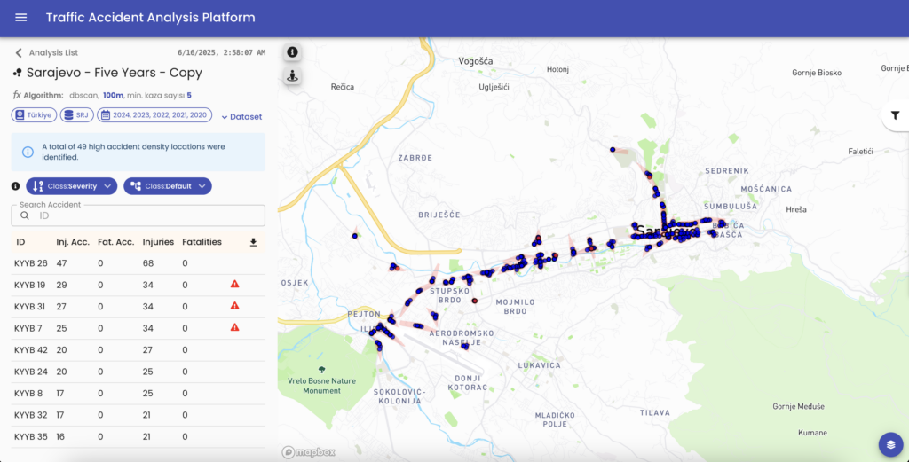
The SAFELY project piloted a traffic safety analysis platform that aims to enhance urban road safety by leveraging data-driven tools to identify hazardous areas, understand accident patterns and implement targeted safety interventions. The solution integrates data from multiple sources including road infrastructure, traffic, weather, and accident reports. The SAFELY solution by Parabol provides a holistic, spatio-temporal view of traffic safety. The platform enables authorities to make data-driven decisions to determine where and how to improve road conditions, evaluate the impact of safety actions, and support strategic planning with localised, actionable insights that make roads safer for all.
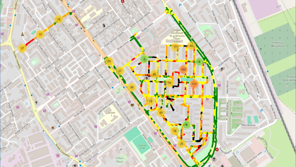
Through pilot demonstrations in Konya, Türkiye; and Sarajevo, Bosnia and Herzegovina; SAFELY integrated historical accident data, user feedback and geospatial analytics to identify and address safety risks. The project successfully developed targeted safety measures and supported measurable improvements in traffic safety in both cities. In Konya, accident data from five years were analysed. Full risk maps were done for 3 priority sites and physical interventions were implemented by the municipality. Survey results indicate that up to 70% of respondents in Konya perceive an improvement in overall traffic safety after the interventions. In Sarajevo, two high-risk locations were analysed revealing safety issues. Issues included illegal parking, low visibility, unprotected crossings, traffic light coordination, and pedestrian infrastructure. Two infrastructural measures were implemented and 45% of respondents reported feeling overall traffic safety had increased.
The SAFELY project was a collaboration between Parabol, the Technical University of Berlin, the Ministry of Traffic of Canton Sarajevo and Konya Metropolitan Municipality.
Towards Vision Zero
Together, ROADSCOR, SAFELIGHT and SAFELY illustrate a shift in how cities can approach road safety to a more proactive, predictive and preventative practice. By using advanced data analytics, artificial intelligence and digital modelling, these projects enable cities to identify risk, prioritise interventions with greater precision, and test solutions before making costly physical changes. Crucially, they place vulnerable road users at the centre of decision-making, addressing long-standing gaps between street design and real-world use. As European cities work towards Vision Zero, scaling and integrating such data-driven approaches will be essential to accelerating progress, saving lives, and creating streets that are safer and more inclusive.