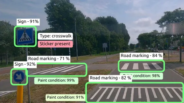
Helsinki wants an up-to-date picture of its streets. Today, it gets that picture in pieces. Traffic counts come from manual surveys, infrastructure condition from occasional street-scanning campaigns and parking occupancy from people counting cars by hand. Each survey costs money, puts another vehicle on the road and captures only one thing at a time. By the time the data are processed, the street has changed.
Arkensight takes a different route. Professional fleet vehicles already drive in Helsinki every day. Put a camera behind the windscreen, connect the feed to Arkensight’s platform and these routine trips become data collection opportunities: no new vehicles, no dedicated missions, no extra traffic.
The platform reads the footage and pulls several things out of the same pass. It detects road users: cars, vans, cyclists and pedestrians, both moving and parked. It maps infrastructure: traffic signs, road markings and kerb stones. It flags changes in the street space, so the city sees when something has been added, removed or damaged. Every detection is placed on the map using satellite positioning and visual positioning, which matters in Helsinki because satellite signals in the region are regularly disrupted.
Arkensight, a Croatian artificial intelligence (AI) company, runs the project with Forum Virium Helsinki, the City of Helsinki’s innovation company, between July and December 2026. Cameras go on a small number of fleet vehicles operating in the city centre. City traffic and infrastructure staff help define what the system should look for, then check the results against what they know is on the ground. The output is structured data and map layers that feed into Helsinki’s existing city systems. If it works, one camera does the job that several separate surveys do today, and the method transfers to any European city with a fleet already on the road.